


Major earthquakes have occurred since time immemorial, but their observation and impact have not been evenly distributed around the globe.
On February 6, two earthquakes struck in Türkiye near the Syrian border. Both registered above a 7 on the Richter scale and have a combined death toll rapidly rising past 20,000 people.
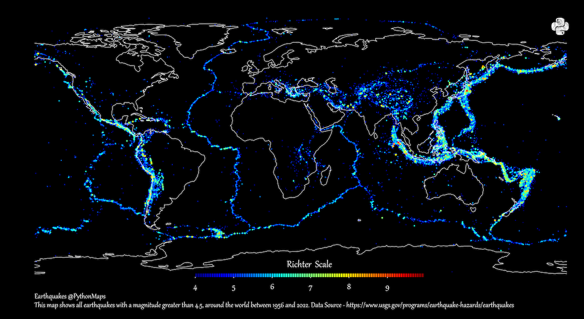
And looking at the history of recent and ancient earthquakes, the location of these is no surprise. Using data from the United States Geological Survey (USGS), creator PythonMaps mapped earthquake epicenters between 1956 and 2022 that registered a 4.5 or higher on the Richter scale.
Tectonic Plate Movement and Earthquakes
Looking at the map, it’s easy to spot the concentration of earthquakes along the boundaries of Earth’s tectonic plates.
These massive moving slabs of rock fit together almost like puzzle pieces, making up the lithosphere or the upper crust. But as the edges of tectonic plates collide, slide against, and move away from each other, the crust cracks and folds and causes earthquakes.
Most of the earthquakes visualized on this map follow the boundaries of the seven major tectonic plates, along with the Philippine Plate (south of Japan) and the Nazca Plate (west of South America)